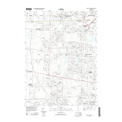
2015 Map of West Chicago
USGS Topo · Published 2015About this map
West Chicago and the neighboring suburban reaches of Cook and DuPage counties appear here as a landscape of established residential grids and remaining pockets of local history. The path of the W Br Du Page River winds south through the center of the sheet, passing near the Wayne Township Cem and the small settlement of Wayne Center. This 2015 survey reflects the dense development patterns around Streamwood and Hanover Park, while still noting smaller historical locales like Ontarioville and Prince Crossing. The presence of several distinct burial grounds, including the Old Ontarioville Cem and the Illinois Pet Cem, provides significant detail for genealogists and local researchers. Large-scale infrastructure, notably the Dupage Airport, anchors the western side of the map, illustrating the modern aviation and transit corridor that defines this portion of the Illinois prairie.
Find a feature on this map
69 named features on this map. Tap any name to fly to it.
Don’t see what you’re looking for? This feature index may not catch every label — zoom into the map to look around manually.
Map Details
Editions of this 2015 West Chicago Map
This is the sole edition of this map. No revisions or reprints were ever made.
Other maps of this area

1908 · Wheaton
USGS Topo · 1:62,500

1923 · Barrington
USGS Topo · 1:62,500

1925 · Elgin
USGS Topo · 1:62,500

1932 · Geneva
USGS Topo · 1:62,500

1935 · Barrington
USGS Topo · 1:62,500

1940 · Elgin
USGS Topo · 1:62,500

1948 · Wheaton
USGS Topo · 1:62,500

1948 · Geneva
USGS Topo · 1:62,500

1949 · Geneva
USGS Topo · 1:24,000

1950 · Aurora North
USGS Topo · 1:24,000