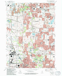
1993 Map of West Chicago
USGS Topo · Published 1994About this map
West Chicago and its surrounding suburbs demonstrate significant late-twentieth-century development along the Cook and Du Page county line. The landscape is a complex mix of expanding residential subdivisions and extensive protected lands, notably the Pratts Wayne Woods County Forest Preserve and the West Chicago Prairie County Forest Preserve. These conservation areas preserve the region's natural character amidst a dense network of transportation corridors, including the Elgin Joliet and Eastern RR and the Chicago and North Western RR. Local history is anchored by established nodes like Bartlett, Wayne, and Winfield, while smaller named locales such as Munger Station and Ingalton mark the evolution of the rail-centered economy. The presence of archaeological sites like the Winfield Mounds and specialized landmarks like the Illinois Pet Cem offer unique historical touchpoints within this suburban fabric.
Find a feature on this map
116 named features on this map. Tap any name to fly to it.
Don’t see what you’re looking for? This feature index may not catch every label — zoom into the map to look around manually.
Map Details
Editions of this 1993 West Chicago Map
This is the sole edition of this map. No revisions or reprints were ever made.
Other maps of this area

1908 · Wheaton
USGS Topo · 1:62,500

1923 · Barrington
USGS Topo · 1:62,500

1925 · Elgin
USGS Topo · 1:62,500

1932 · Geneva
USGS Topo · 1:62,500

1935 · Barrington
USGS Topo · 1:62,500

1940 · Elgin
USGS Topo · 1:62,500

1948 · Wheaton
USGS Topo · 1:62,500

1948 · Geneva
USGS Topo · 1:62,500

1949 · Geneva
USGS Topo · 1:24,000

1950 · Aurora North
USGS Topo · 1:24,000