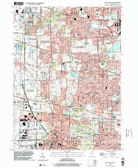
1998 Map of West Chicago
USGS Topo · Published 2002About this map
The West Branch Du Page River carves through a landscape of preserved wetlands and expanding suburban corridors in this late 1990s survey. Extensive greenbelts like the Pratts Wayne Woods County Forest Preserve and Hawk Hollow County Forest Preserve buffer the established communities of West Chicago, Bartlett, and Carol Stream. The map captures a transitional era for DuPage County, where old rail markers like Munger Station and the Elgin Joliet and Eastern RR intersect with modern infrastructure like the Du Page County Airport. Notable local landmarks include the Drive-in Theater near Prince Crossing and the Winfield Mounds Co For Presv, illustrating the juxtaposition of mid-century recreation with the preservation of indigenous historical sites.
Find a feature on this map
100 named features on this map. Tap any name to fly to it.
Don’t see what you’re looking for? This feature index may not catch every label — zoom into the map to look around manually.
Map Details
Editions of this 1998 West Chicago Map
This is the sole edition of this map. No revisions or reprints were ever made.
Other maps of this area

1908 · Wheaton
USGS Topo · 1:62,500

1923 · Barrington
USGS Topo · 1:62,500

1925 · Elgin
USGS Topo · 1:62,500

1932 · Geneva
USGS Topo · 1:62,500

1935 · Barrington
USGS Topo · 1:62,500

1940 · Elgin
USGS Topo · 1:62,500

1948 · Wheaton
USGS Topo · 1:62,500

1948 · Geneva
USGS Topo · 1:62,500

1949 · Geneva
USGS Topo · 1:24,000

1950 · Aurora North
USGS Topo · 1:24,000