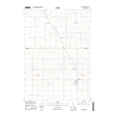
2016 Map of West Concord
USGS Topo · Published 2016About this map
West Concord sits at the intersection of a grid-iron road network and the upper reaches of the Middle Fork Zumbro River, defining the southeastern quadrant of this Dodge County landscape. The town plan is densely packed compared to the sprawling agricultural sections surrounding it, showing a concentration of community life near Co Hwy 24. To the north, the small settlement of Skyberg marks a significant waypoint along the diagonal path of the former railroad corridor that cuts across the township lines of t109n r18w and t109n r17w. This diagonal alignment provides a sharp contrast to the cardinal-direction section lines that organize the region's farms.
Find a feature on this map
89 named features on this map. Tap any name to fly to it.
Don’t see what you’re looking for? This feature index may not catch every label — zoom into the map to look around manually.
Map Details
Editions of this 2016 West Concord Map
This is the sole edition of this map. No revisions or reprints were ever made.
Other maps of this area

1953 · Saint Paul
USGS Topo · 1:250,000

1959 · Saint Paul
USGS Topo · 1:250,000

1960 · Nerstrand
USGS Topo · 1:24,000

1962 · Moland
USGS Topo · 1:24,000

1962 · Owatonna SE
USGS Topo · 1:24,000

1965 · Dodge Center
USGS Topo · 1:24,000

1965 · Concord
USGS Topo · 1:24,000

1965 · Claremont
USGS Topo · 1:24,000

1965 · West Concord
USGS Topo · 1:24,000

1968 · Kenyon
USGS Topo · 1:24,000
Featured Places
- West Concord, MN
- Cherry Grove Township, MN
- Kenyon Township, MN
- West Gate Mobile Home Park, West Concord
- Skyberg, MN