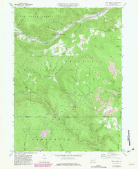
1969 Map of West Creek
USGS Topo · Published 1982About this map
Elk State Forest and State Game Lands No 14 dominate this 1969 topographic study, where the border between Elk and Cameron counties follows the high ridges. The landscape is defined by the deep incisions of West Creek and its many tributaries, such as Big Run and Bender Run. Industrial activity is evident in the numerous Gas Well sites and Strip Mine operations that pockmark the hillsides, particularly in the eastern sections of the quadrangle. Transportation is focused along the valley floors, where the Conrail line tracks the water's edge through Truman and Howard Siding. In addition to the extractive industries, the map records a local Cem near the confluence of Cards Hollow and a Heliport on Whittimore Hill, reflecting a specialized modern use of these high elevations.
Find a feature on this map
53 named features on this map. Tap any name to fly to it.
Don’t see what you’re looking for? This feature index may not catch every label — zoom into the map to look around manually.
Map Details
Editions of this 1969 West Creek Map
3 editions found
Other maps of this area

1941 · Benezette
USGS Topo · 1:62,500

1943 · Benezette
USGS Topo · 1:62,500

1945 · Driftwood
USGS Topo · 1:48,000

1945 · Driftwood
USGS Topo · 1:24,000

1945 · Cameron
USGS Topo · 1:24,000

1947 · Cameron
USGS Topo · 1:24,000
1947 · Driftwood
USGS Topo · 1:24,000

1948 · Crosby
USGS Topo · 1:62,500

1948 · Emporium
USGS Topo · 1:62,500

1948 · Emporium
USGS Topo · 1:24,000
Featured Places
- Benezette Township, PA
- Lumber Township, PA
- Shippen Township, PA
- Gibson Township, PA
- West Creek, Shippen Township