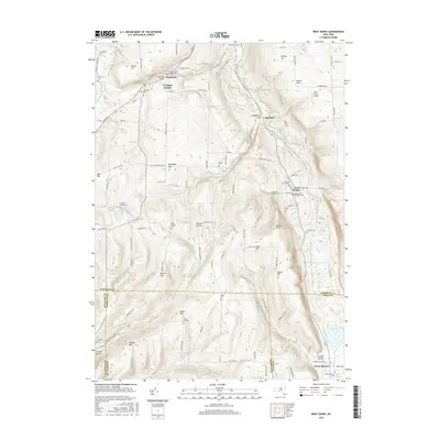
2016 Map of West Danby
USGS Topo · Published 2016About this map
Newfield Hamlet and the nearby village of Newfield anchor the northwestern hills of this Tompkins County landscape, where the geography is defined by deep cuts like VanBuskirk Gulf and the winding course of the W Br Cayuga Inlet. The map reveals a high density of small family and community burial grounds, including the Hine Family Cem and Larue Cem, which speak to the generations of agricultural life in Cornish Hollow and across Beech Hill. Toward the southern border, the terrain transitions into the Tioga County line near North Spencer and the headwaters of Spencer Lake. Transportation patterns are dictated by the steep ridges of Protts Hill and Dawes Hill, with rural routes like Elmira Rd connecting these isolated upland settlements to the valley floors.
Find a feature on this map
117 named features on this map. Tap any name to fly to it.
Don’t see what you’re looking for? This feature index may not catch every label — zoom into the map to look around manually.
Map Details
Editions of this 2016 West Danby Map
This is the sole edition of this map. No revisions or reprints were ever made.
Other maps of this area

1893 · Ithaca
USGS Topo · 1:62,500

1895 · Ithaca
USGS Topo · 1:62,500

1900 · Dryden
USGS Topo · 1:62,500

1902 · Waverly
USGS Topo · 1:62,500

1903 · Owego
USGS Topo · 1:62,500

1905 · Watkins Glen
USGS Topo · 1:125,000

1906 · Catatonk
USGS Topo · 1:125,000

1949 · Ithaca West
USGS Topo · 1:24,000

1949 · Ithaca East
USGS Topo · 1:24,000

1949 · Willseyville
USGS Topo · 1:24,000