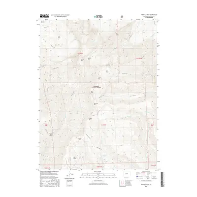
2016 Map of West Elk Peak
USGS Topo · Published 2016About this map
West Elk Peak and the surrounding high-altitude terrain of the Gunnison National Forest define this landscape within the West Elk Mountains. This survey documents a complex system of drainage and movement across high basins, including Soap Basin and Mill Basin. The presence of the Highline Ditch in the northeast corner indicates early water management efforts to divert runoff from high-elevation creeks like Castle Cr for lower-lying agricultural use. A dense network of pack trails, such as the Mill Castle Trail and Beaver Creek Trail, underscores the area's history as a thoroughfare for forest rangers, hunters, and early explorers moving through critical gaps like Storm Pass. Notable geological features like The Castles and several peaks, including N Baldy Mtn and S Baldy Mtn, serve as primary landmarks in this roadless alpine environment.
Find a feature on this map
43 named features on this map. Tap any name to fly to it.
Don’t see what you’re looking for? This feature index may not catch every label — zoom into the map to look around manually.
Map Details
Editions of this 2016 West Elk Peak Map
This is the sole edition of this map. No revisions or reprints were ever made.
Other maps of this area

1888 · Anthracite
USGS Topo · 1:62,500

1889 · Anthracite
USGS Topo · 1:62,500

1893 · Anthracite
USGS Topo · 1:62,500

1894 · Anthracite
USGS Topo · 1:62,500

1938 · Mt. Gunnison
USGS Topo · 1:48,000

1945 · Mount Gunnison
USGS Topo · 1:62,500

1954 · Mc Intosh Mountain
USGS Topo · 1:24,000

1954 · West Elk Peak SW
USGS Topo · 1:24,000

1954 · Little Soap Park
USGS Topo · 1:24,000

1956 · Montrose
USGS Topo · 1:250,000