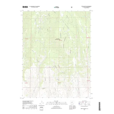
2019 Map of West Elk Peak SW
USGS Topo · Published 2019About this map
Gunnison National Forest encompasses this high-altitude landscape in western Colorado, characterized by a complex network of steep gulches and high mesas. The terrain is defined by dramatic relief, rising from Dillon Mesa in the southwest toward numerous named canyons including Lion Gulch, Deadman Gulch, and the prominent Bear Wallow Gulch. This 2019 survey documents the intricate drainage systems that feed into West Elk Cr and Willow Creek, reflecting the natural hydrology that has shaped the region's topography for centuries.
Find a feature on this map
46 named features on this map. Tap any name to fly to it.
Don’t see what you’re looking for? This feature index may not catch every label — zoom into the map to look around manually.
Map Details
Editions of this 2019 West Elk Peak SW Map
This is the sole edition of this map. No revisions or reprints were ever made.
Other maps of this area

1908 · Uncompahgre
USGS Topo · 1:125,000

1911 · Uncompahgre
USGS Topo · 1:125,000

1954 · Iola
USGS Topo · 1:24,000

1954 · Mc Intosh Mountain
USGS Topo · 1:24,000

1954 · West Elk Peak SW
USGS Topo · 1:24,000

1954 · Little Soap Park
USGS Topo · 1:24,000

1954 · Cebolla
USGS Topo · 1:24,000

1954 · Sapinero
USGS Topo · 1:24,000

1956 · Montrose
USGS Topo · 1:250,000

1959 · Montrose
USGS Topo · 1:250,000