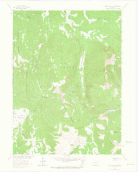
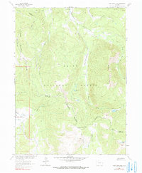
1962 Map of West Fork Lake
USGS Topo · Published 1964About this map
The Continental Divide winds through the high country of the Sierra Madre in this early 1960s survey of the Colorado-Wyoming border region. Spanning the Jackson County and Routt County line within the Routt National Forest, the landscape is defined by the headwaters of the West Fork Encampment River and its numerous tributaries. High-altitude water bodies like West Fork Lake, Manzanares Lake, and the Sanchez Lakes are scattered among prominent peaks such as Black Mountain. The absence of developed roads highlights the reliance on a network of historic thoroughfares, including the Pack Trail, Jeep Trail, and a Stock Driveway. This network suggests an era of seasonal grazing and backcountry access, connecting landmarks like West Fork Meadows and Big Red Park before the expansion of modern forest infrastructure.
Find a feature on this map
21 named features on this map. Tap any name to fly to it.
Don’t see what you’re looking for? This feature index may not catch every label — zoom into the map to look around manually.
Map Details
Editions of this 1962 West Fork Lake Map
5 editions found
Other maps of this area

1911 · Hahns Peak
USGS Topo · 1:125,000

1913 · Hahns Peak
USGS Topo · 1:125,000

1939 · Saratoga
USGS Topo · 1:125,000

1954 · Rawlins
USGS Topo · 1:250,000

1954 · Craig
USGS Topo · 1:250,000

1955 · Davis Peak
USGS Topo · 1:24,000

1955 · Mount Zirkel
USGS Topo · 1:24,000

1956 · Pearl
USGS Topo · 1:62,500

1957 · Craig
USGS Topo · 1:250,000

1958 · Rawlins
USGS Topo · 1:250,000