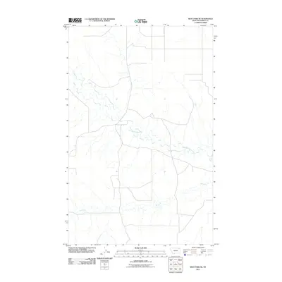
2011 Map of West Fork NE
USGS Topo · Published 2011About this map
The West Fork Poplar River carves a winding path through this corner of the Wolf Point District, anchoring a landscape defined by its remote drainage systems. This 2011 survey illustrates the rural infrastructure of Roosevelt County, where the dendritic patterns of Hell Creek and its unnamed tributaries dominate the terrain. Human presence is marked by a sparse network of section-line roads, including Fladager Rd, which provides one of the few named navigational markers in this sparsely populated stretch of northeastern Montana. The map reveals the relationship between the natural hydrology of the Poplar River basin and the gridded land management typical of the American West, offering a precise view of the topography before contemporary shifts in land use or environmental change.
Find a feature on this map
3 named features on this map. Tap any name to fly to it.
Don’t see what you’re looking for? This feature index may not catch every label — zoom into the map to look around manually.
Map Details
Editions of this 2011 West Fork NE Map
This is the sole edition of this map. No revisions or reprints were ever made.
Other maps of this area

1954 · Wolf Point
USGS Topo · 1:250,000

1958 · Wolf Point
USGS Topo · 1:250,000

1973 · Horseshoe Basin
USGS Topo · 1:24,000

1973 · West Fork NE
USGS Topo · 1:24,000

1973 · Peerless
USGS Topo · 1:24,000

1973 · Killenbeck Reservoir
USGS Topo · 1:24,000

1973 · Haugens Hill
USGS Topo · 1:24,000

1973 · Peerless 4 SW
USGS Topo · 1:24,000

1973 · Poplar Coulee
USGS Topo · 1:24,000
1973 · West Fork
USGS Topo · 1:24,000