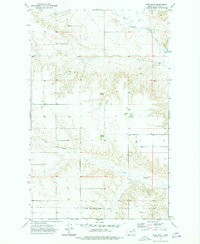
1973 Map of West Fork
USGS Topo · Published 1977About this map
The West Fork Poplar River winds through the northern portion of this 1973 Montana landscape, marking a region defined by extensive plateau drainages and seasonal water sources. The southern half of the map is significantly bisected by the Fort Peck Indian Reservation Boundary, a critical demarcation for land use and local jurisdictional history. The small settlement of West Fork sits near the eastern edge, serving as a rare point of habitation in an area primarily characterized by its natural hydrological features.
Find a feature on this map
7 named features on this map. Tap any name to fly to it.
Don’t see what you’re looking for? This feature index may not catch every label — zoom into the map to look around manually.
Map Details
Editions of this 1973 West Fork Map
This is the sole edition of this map. No revisions or reprints were ever made.
Other maps of this area

1954 · Wolf Point
USGS Topo · 1:250,000

1954 · Glasgow
USGS Topo · 1:250,000

1957 · Glasgow
USGS Topo · 1:250,000

1958 · Wolf Point
USGS Topo · 1:250,000

1958 · Glasgow
USGS Topo · 1:250,000

1973 · Horseshoe Basin
USGS Topo · 1:24,000

1973 · West Fork NE
USGS Topo · 1:24,000

1973 · Peerless
USGS Topo · 1:24,000

1973 · Johnnys Hill
USGS Topo · 1:24,000

1973 · Richland
USGS Topo · 1:24,000