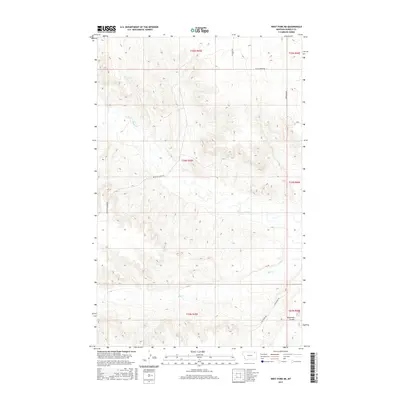
2017 Map of West Fork NE
USGS Topo · Published 2017About this map
W Fork Poplar River meanders across the northern reaches of this Daniels County landscape, which is characterized by the complex drainage systems of the Missouri River basin. The geography is defined by a network of named section roads and drainage features, including the prominent Shipstead Coulee in the southeast and the winding path of Hell Cr through the central and southern portions. These landforms reveal the intricate topography of the high plains, where subtle elevation changes dictate the flow of seasonal water towards the river systems. Local history is etched into the landscape via the transportation network, with routes like Peerless Lustre Rd and Fladager Rd providing essential connections between agricultural sections. The presence of family-named thoroughfares such as W Willcoxon Rd and J Willcoxon Rd offers a tangible link to the homesteading legacy of this corner of Montana.
Find a feature on this map
15 named features on this map. Tap any name to fly to it.
Don’t see what you’re looking for? This feature index may not catch every label — zoom into the map to look around manually.
Map Details
Editions of this 2017 West Fork NE Map
This is the sole edition of this map. No revisions or reprints were ever made.
Other maps of this area

1954 · Wolf Point
USGS Topo · 1:250,000

1958 · Wolf Point
USGS Topo · 1:250,000

1973 · Horseshoe Basin
USGS Topo · 1:24,000

1973 · West Fork NE
USGS Topo · 1:24,000

1973 · Peerless
USGS Topo · 1:24,000

1973 · Killenbeck Reservoir
USGS Topo · 1:24,000

1973 · Haugens Hill
USGS Topo · 1:24,000

1973 · Peerless 4 SW
USGS Topo · 1:24,000

1973 · Poplar Coulee
USGS Topo · 1:24,000
1973 · West Fork
USGS Topo · 1:24,000