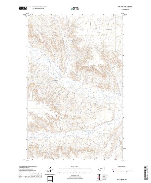
2024 Map of West Fork NE
USGS Topo · Published 2024About this map
West Fork Cem stands as a quiet focal point in this sparsely settled corner of Daniels County, marking a location of significant local heritage. The landscape is defined by the meandering path of the West Fork Poplar River, which cuts through the northern and central sections, joined further south by the seasonal drainage of Hell Creek. A network of rural section-line roads, including Peerless Lustre Rd and Shipstead Rd, provides access across the townships. The terrain is characterized by the distinct draws of Shipstead Coulee, illustrating the erosional patterns common to the high plains of northern Montana. This 2024 survey documents the current distribution of property boundaries and watercourses, reflecting the enduring agricultural and ranching character of the region.
Find a feature on this map
16 named features on this map. Tap any name to fly to it.
Don’t see what you’re looking for? This feature index may not catch every label — zoom into the map to look around manually.
Map Details
Editions of this 2024 West Fork NE Map
This is the sole edition of this map. No revisions or reprints were ever made.
Other maps of this area

1954 · Wolf Point
USGS Topo · 1:250,000

1958 · Wolf Point
USGS Topo · 1:250,000

1973 · Horseshoe Basin
USGS Topo · 1:24,000

1973 · West Fork NE
USGS Topo · 1:24,000

1973 · Peerless
USGS Topo · 1:24,000

1973 · Killenbeck Reservoir
USGS Topo · 1:24,000

1973 · Haugens Hill
USGS Topo · 1:24,000

1973 · Peerless 4 SW
USGS Topo · 1:24,000

1973 · Poplar Coulee
USGS Topo · 1:24,000
1973 · West Fork
USGS Topo · 1:24,000