
1973 Map of West Fork NE
USGS Topo · Published 1976About this map
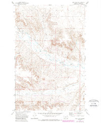
The Fort Peck Indian Reservation Boundary runs along the southern edge of this Montana landscape, where the West Fork Poplar River meanders through a network of deeply eroded coulees and drainages. Mapping from the early 1970s reveals a sparse, high-plains terrain defined more by hydrology and legal boundaries than by human settlement. Small-scale resource extraction is noted by a solitary Gravel Pit in the northern reaches, while the survival of livestock in this arid environment is marked by scattered sources such as Spring and Well. The southern portion of the sheet is dominated by the namesake drainage of Hell Creek and the long, winding Shipstead Coulee, illustrating the intricate topographical dissection of the prairie before it meets the reservation line.
Find a feature on this map
8 named features on this map. Tap any name to fly to it.
Don’t see what you’re looking for? This feature index may not catch every label — zoom into the map to look around manually.
Map Details
Editions of this 1973 West Fork NE Map
2 editions found
Other maps of this area

1954 · Wolf Point
USGS Topo · 1:250,000

1958 · Wolf Point
USGS Topo · 1:250,000

1973 · Horseshoe Basin
USGS Topo · 1:24,000

1973 · Peerless
USGS Topo · 1:24,000

1973 · Killenbeck Reservoir
USGS Topo · 1:24,000

1973 · Haugens Hill
USGS Topo · 1:24,000

1973 · Peerless 4 SW
USGS Topo · 1:24,000

1973 · Poplar Coulee
USGS Topo · 1:24,000
1973 · West Fork
USGS Topo · 1:24,000
1973 · Peerless 4 NW
USGS Topo · 1:24,000