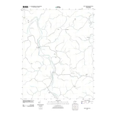
2011 Map of West Hamlin
USGS Topo · Published 2011About this map
The Guyandotte River carves a central path through this portion of Lincoln and Cabell counties, anchoring a landscape defined by narrow hollows and numerous family cemeteries. Settlement centers on Salt Rock and Inez, where the river’s bend creates a focus for local transportation along McComas Rd and Guyan Creek Rd. The map reveals a dense network of genealogical interest, with burial sites such as the Hatfield Cemetery, Swann Cemetery, and Triplett Cemetery dotting the ridges and hillsides. To the east, the Mud River valley hosts the community of Portersville near Balls Gap. Significant local landmarks include Lees Fishing Lake Dam and prominent elevations like Porter Knob. The distribution of these features reflects a traditional Appalachian settlement pattern where residential life and community memory are tightly bound to the specific drainage of every branch and fork.
Find a feature on this map
84 named features on this map. Tap any name to fly to it.
Don’t see what you’re looking for? This feature index may not catch every label — zoom into the map to look around manually.
Map Details
Editions of this 2011 West Hamlin Map
This is the sole edition of this map. No revisions or reprints were ever made.
Other maps of this area

1892 · Huntington
USGS Topo · 1:125,000

1898 · Huntington
USGS Topo · 1:125,000

1901 · Guyandot
USGS Topo · 1:62,500

1902 · Guyandot
USGS Topo · 1:62,500

1902 · Milton
USGS Topo · 1:62,500

1902 · Midkiff
USGS Topo · 1:62,500

1907 · Midkiff
USGS Topo · 1:62,500

1909 · Wayne
USGS Topo · 1:62,500

1909 · Midkiff
USGS Topo · 1:62,500

1931 · Wayne
USGS Topo · 1:62,500