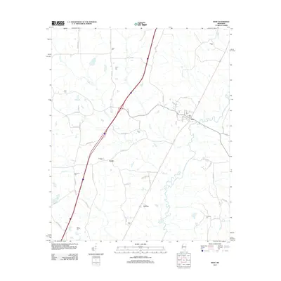
2012 Map of West
USGS Topo · Published 2012About this map
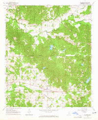
The town of West sits at the confluence of several rural transport corridors, where the winding path of the Big Black River meets the modern sweep of the interstate and the historical route of Old Hwy 51. This 2012 landscape in Holmes County is defined by its numerous family and community burial grounds, reflecting generations of settlement along the creek beds and ridges. Small hamlets like Edsville and Hoffman remain visible as established clusters within a landscape dissected by Jordan Cr and Kyle Cr. The transition from old county roads such as Wade Rd and Race Track Rd to the large-scale highway infrastructure illustrates the shifting pace of movement through central Mississippi. Genealogists will find a dense concentration of local history here, with sites ranging from the West Cem near the town center to the remote Rocky Springs Cem in the southwestern reaches of the quadrangle.
Find a feature on this map
60 named features on this map. Tap any name to fly to it.
Don’t see what you’re looking for? This feature index may not catch every label — zoom into the map to look around manually.
Map Details
Editions of this 2012 West Map
This is the sole edition of this map. No revisions or reprints were ever made.
Other maps of this area

1953 · West Point
USGS Topo · 1:250,000

1958 · West Point
USGS Topo · 1:250,000

1963 · West Point
USGS Topo · 1:250,000

1964 · West
USGS Topo · 1:24,000
1964 · Bowling Green
USGS Topo · 1:24,000

1964 · Hesterville
USGS Topo · 1:24,000
1964 · Durant
USGS Topo · 1:24,000
1964 · Owens Wells
USGS Topo · 1:24,000
1964 · McAdams
USGS Topo · 1:24,000

1966 · Kosciusko
USGS Topo · 1:62,500