2024 Map of West
USGS Topo · Published 2024About this map
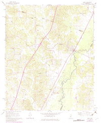
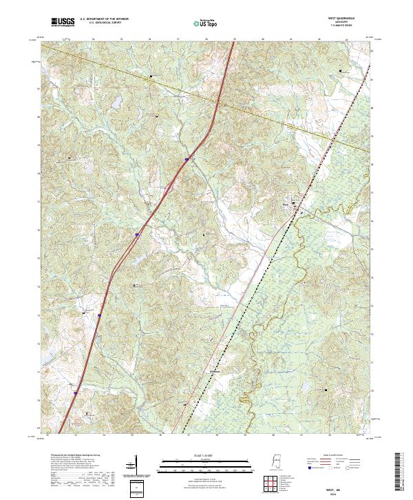
The Big Black River meanders along the eastern border of this Holmes County landscape, defining the boundary with Attala County. The town of West serves as a central hub where the modern Interstate 55 corridor intersects with the historical path of Old Hwy 51. This area is characterized by a dense concentration of family and community burial grounds, such as Bagley Cem, Wilkes Cem, and Moorhead Cem, which offer significant value for genealogical research. The terrain is crisscrossed by established local routes like Old Wheeling Rd and Race Track Rd, tracing the movement of residents between small settlements like Hoffman and the surrounding agricultural lands. The numerous creek systems, including Kyle Creek and Jordan Creek, highlight the natural drainage patterns that have influenced settlement and land use in this part of Mississippi.
Find a feature on this map
43 named features on this map. Tap any name to fly to it.
Don’t see what you’re looking for? This feature index may not catch every label — zoom into the map to look around manually.
Map Details
Editions of this 2024 West Map
This is the sole edition of this map. No revisions or reprints were ever made.