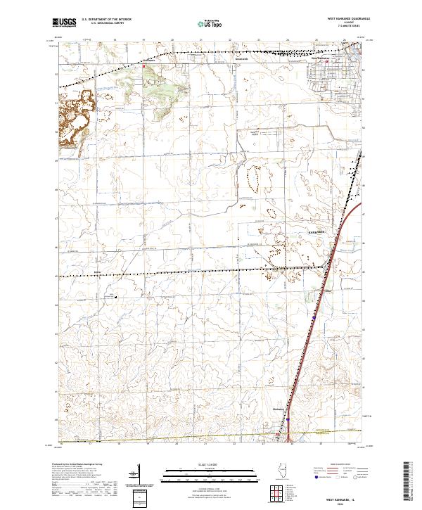
2024 Map of West Kankakee
USGS Topo · Published 2024About this map
Kankakee and its surrounding prairie landscapes are defined by a network of agricultural roads and small watercourses that feed into the Kankakee River. This modern survey documents the interface between the urban growth of West Kankakee and the rural townships of Limestone and Irwin. The landscape is etched by drainage ways like Minnie Creek, Gar Creek, and Wiley Creek, which reflect the historic drainage patterns essential to Illinois farming. Notable landmarks include the Kankakee Airport and the quiet presence of Saint James Cem near the western edge. Towards the south, the map captures the transition across the Kankakee Co Iroquois Co boundary near Chebanse, showing the infrastructure that connects these small rail-side and roadside communities like Otto.
Find a feature on this map
63 named features on this map. Tap any name to fly to it.
Don’t see what you’re looking for? This feature index may not catch every label — zoom into the map to look around manually.
Map Details
Editions of this 2024 West Kankakee Map
This is the sole edition of this map. No revisions or reprints were ever made.
Other maps of this area

1922 · Kankakee
USGS Topo · 1:62,500

1923 · Herscher
USGS Topo · 1:62,500

1924 · Kankakee
USGS Topo · 1:62,500

1925 · Herscher
USGS Topo · 1:62,500

1944 · Piper City
USGS Topo · 1:48,000

1944 · Gilman
USGS Topo · 1:62,500

1946 · Gilman
USGS Topo · 1:62,500

1947 · Piper City
USGS Topo · 1:62,500

1953 · Chicago
USGS Topo · 1:250,000

1953 · Danville
USGS Topo · 1:250,000