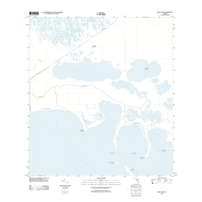
2012 Map of West Lake
USGS Topo · Published 2012About this map
Florida Bay and the interconnected labyrinth of the Florida mangrove coast dominate this 2012 survey. The landscape is defined by extensive brackish water bodies including West Lake, Cuthbert Lake, and the distinctly shaped The Lungs. Coastal features such as Shark Point and Porpoise Point divide shallow estuaries like Rankin Bight and Garfield Bight, while navigation and access are marked by the Snake Bight Canal and primitive paths like the Crocodile Point Trl.
Find a feature on this map
28 named features on this map. Tap any name to fly to it.
Don’t see what you’re looking for? This feature index may not catch every label — zoom into the map to look around manually.
Map Details
Editions of this 2012 West Lake Map
This is the sole edition of this map. No revisions or reprints were ever made.
Other maps of this area

1956 · Miami
USGS Topo · 1:250,000

1958 · Miami
USGS Topo · 1:250,000

1972 · Whitewater Bay East
USGS Topo · 1:24,000

1972 · Mahogany Hammock
USGS Topo · 1:24,000

1972 · Taylor Slough
USGS Topo · 1:24,000

1972 · Madeira Bay
USGS Topo · 1:24,000

1972 · Pelican Keys
USGS Topo · 1:24,000

1972 · West Lake
USGS Topo · 1:24,000

1972 · Calusa Keys
USGS Topo · 1:24,000

1972 · Clive Key
USGS Topo · 1:24,000