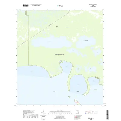
2018 Map of West Lake
USGS Topo · Published 2018About this map
Everglades National Park covers the vast majority of this landscape, where the transition from freshwater marshes to saltwater estuaries is mapped in fine detail. The coastal margin along Florida Bay is defined by a complex series of bights and points, including Snake Bight, Garfield Bight, and Rankin Bight. These shallow waters are separated from the interior by dense networks of mangroves and tidal creeks such as Alligator Creek. Inland, the map reveals a mosaic of water bodies including West Lake, Cuthbert Lake, and the uniquely named The Lungs. Access is provided primarily by the Main Park Rd, which skirts the edge of Noble Hammock. This map provides a modern look at the shifting boundaries of the Florida coast, illustrating the various keys and rookeries, such as Rookery Key, that serve as critical habitats within the park system.
Find a feature on this map
29 named features on this map. Tap any name to fly to it.
Don’t see what you’re looking for? This feature index may not catch every label — zoom into the map to look around manually.
Map Details
Editions of this 2018 West Lake Map
This is the sole edition of this map. No revisions or reprints were ever made.
Other maps of this area

1956 · Miami
USGS Topo · 1:250,000

1958 · Miami
USGS Topo · 1:250,000

1972 · Whitewater Bay East
USGS Topo · 1:24,000

1972 · Mahogany Hammock
USGS Topo · 1:24,000

1972 · Taylor Slough
USGS Topo · 1:24,000

1972 · Madeira Bay
USGS Topo · 1:24,000

1972 · Pelican Keys
USGS Topo · 1:24,000

1972 · West Lake
USGS Topo · 1:24,000

1972 · Calusa Keys
USGS Topo · 1:24,000

1972 · Clive Key
USGS Topo · 1:24,000