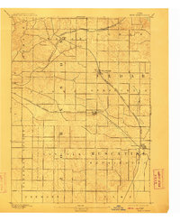
1894 Map of West Liberty
USGS Topo · Published 1910About this map
West Liberty and the surrounding townships of Muscatine and Cedar counties are captured here during a period of significant agricultural and rail expansion. The landscape is defined by the drainage of Wapsinonoc Creek and its Middle Branch, which cut through the undulating terrain of Wapsinonoc and Springdale. The intersection of major rail lines, including the Chicago Rock Island and Pacific Railroad, facilitated the growth of small shipping points and rural communities.
Find a feature on this map
25 named features on this map. Tap any name to fly to it.
Don’t see what you’re looking for? This feature index may not catch every label — zoom into the map to look around manually.
Map Details
Editions of this 1894 West Liberty Map
2 editions found
Other maps of this area

1887 · Cedar Rapids
USGS Topo · 1:62,500

1889 · Tipton
USGS Topo · 1:62,500

1890 · Tipton
USGS Topo · 1:62,500

1891 · Mechanicsville
USGS Topo · 1:62,500

1891 · Cedar Rapids
USGS Topo · 1:62,500

1891 · Iowa City
USGS Topo · 1:62,500

1891 · Wilton Junction
USGS Topo · 1:62,500

1894 · Mechanicsville
USGS Topo · 1:62,500

1894 · West Liberty
USGS Topo · 1:62,500

1901 · Stanwood
USGS Topo · 1:125,000