
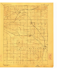
1894 Map of West Liberty
USGS Topo · Published 1894About this map
West Liberty and the surrounding townships of Wapsinonoc and Springdale are defined by the convergence of two major nineteenth-century rail lines. The Burlington Cedar Rapids and Northern Railroad cuts diagonally across the landscape, intersecting with the Chicago Rock Island and Pacific Railroad at several key junctions. This transport network facilitated the growth of small agricultural hubs like West Branch, Downey, and Elmira.
Find a feature on this map
23 named features on this map. Tap any name to fly to it.
Don’t see what you’re looking for? This feature index may not catch every label — zoom into the map to look around manually.
Map Details
Editions of this 1894 West Liberty Map
2 editions found
Other maps of this area

1887 · Cedar Rapids
USGS Topo · 1:62,500

1889 · Tipton
USGS Topo · 1:62,500

1890 · Tipton
USGS Topo · 1:62,500

1891 · Mechanicsville
USGS Topo · 1:62,500

1891 · Cedar Rapids
USGS Topo · 1:62,500

1891 · Iowa City
USGS Topo · 1:62,500

1891 · Wilton Junction
USGS Topo · 1:62,500

1894 · Mechanicsville
USGS Topo · 1:62,500

1901 · Stanwood
USGS Topo · 1:125,000

1903 · Fairfax
USGS Topo · 1:125,000