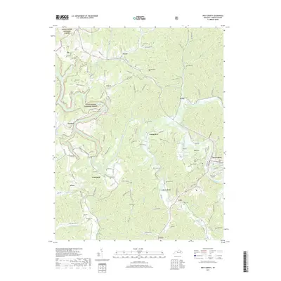
2019 Map of West Liberty
USGS Topo · Published 2019About this map
West Liberty serves as the focal point of this Morgan County landscape, situated along the winding banks of the Licking River. The region is defined by a dense network of family-named cemeteries and small rural settlements like Zag, Yocum, and Woodsbend, reflecting a deeply rooted community structure in eastern Kentucky. To the west, the boundaries of the Daniel Boone National Forest encompass topographic landmarks such as McClannahan Hill and Daisy Knob. The map details an intricate system of creeks and branches, including Caney Cr, Greasy Cr, and Elk Fork, which have historically dictated the placement of roads and homesteads. Modern infrastructure is represented by the West Liberty Airport southeast of the main town, while numerous small burial grounds like Cottle Cem, Oakley Cem, and Potter Cem provide significant data points for genealogical research into the area's prominent local families.
Find a feature on this map
133 named features on this map. Tap any name to fly to it.
Don’t see what you’re looking for? This feature index may not catch every label — zoom into the map to look around manually.
Map Details
Editions of this 2019 West Liberty Map
This is the sole edition of this map. No revisions or reprints were ever made.
Other maps of this area

1889 · Salyersville
USGS Topo · 1:125,000

1891 · Salyersville
USGS Topo · 1:125,000

1899 · Salyersville
USGS Topo · 1:125,000

1929 · Morehead
USGS Topo · 1:48,000

1935 · Morehead
USGS Topo · 1:62,500

1950 · Sandy Hook
USGS Topo · 1:24,000

1950 · Lenox
USGS Topo · 1:24,000

1951 · Cannel City
USGS Topo · 1:24,000

1951 · White Oak
USGS Topo · 1:24,000

1951 · Ezel
USGS Topo · 1:24,000