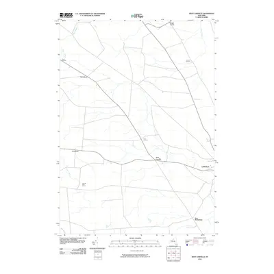
2010 Map of West Lowville
USGS Topo · Published 2010About this map
West Lowville sits at the heart of this Lewis County landscape, where the agricultural plateaus are etched by a dense network of waterways including Mill Creek, Cobb Creek, and Stony Creek. The settlement pattern reflects a long history of rural development, anchored by hamlets such as Harrisburg and Windecker. For genealogists, the map provides precise locations for several burial grounds, including Gallup Cemetery in the northwest and Fairview Cemetery near Briggs Corner. The inclusion of the Tug Hill Farm Airport highlights the specialized land use in this upland region, while the eastern edge captures the residential outskirts of the larger village of Lowville. The drainage patterns of Negro Creek and Mud Creek illustrate the natural topography that has influenced road placement and property boundaries throughout the town's history.
Find a feature on this map
15 named features on this map. Tap any name to fly to it.
Don’t see what you’re looking for? This feature index may not catch every label — zoom into the map to look around manually.
Map Details
Editions of this 2010 West Lowville Map
This is the sole edition of this map. No revisions or reprints were ever made.
Other maps of this area

1902 · Carthage
USGS Topo · 1:62,500

1904 · Carthage
USGS Topo · 1:62,500

1905 · Port Leyden
USGS Topo · 1:62,500

1906 · Highmarket
USGS Topo · 1:62,500

1907 · Port Leyden
USGS Topo · 1:62,500

1911 · Lowville
USGS Topo · 1:62,500

1913 · Lowville
USGS Topo · 1:62,500

1940 · Port Leyden
USGS Topo · 1:62,500

1942 · Copenhagen
USGS Topo · 1:24,000

1943 · Copenhagen
USGS Topo · 1:31,680