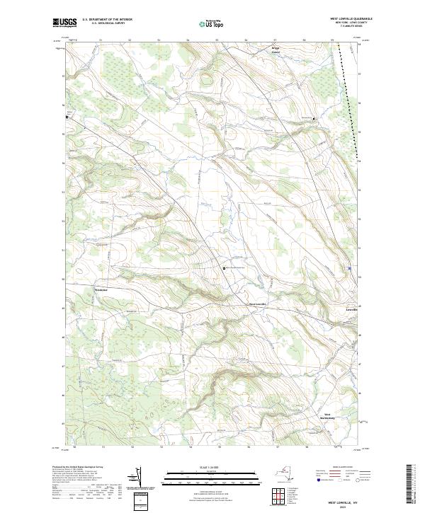
2023 Map of West Lowville
USGS Topo · Published 2023About this map
West Lowville and its surrounding rural uplands characterize this portion of Lewis County, where the terrain transitions toward the Tug Hill Plateau. The settlement pattern is defined by long, straight thoroughfares such as Number Three Rd and Rector Rd, which connect scattered farmsteads and historic hamlets like Windecker and Briggs Corner. Local heritage is preserved in several small burial grounds, including the West Lowville Rural Cem and Gallup Cem, which anchor the early families of the area to the landscape. Drainage for the region is provided by Mill Creek and Stony Creek, which cut through the agricultural fields and woodlots. The map captures the edge of the larger village of Lowville in the east, while the western reaches, including West Martinsburg, remain dominated by a network of local connectors like Boshart Rd and Mud St that have served the dairy and timber landscape for generations.
Find a feature on this map
54 named features on this map. Tap any name to fly to it.
Don’t see what you’re looking for? This feature index may not catch every label — zoom into the map to look around manually.
Map Details
Editions of this 2023 West Lowville Map
This is the sole edition of this map. No revisions or reprints were ever made.
Other maps of this area

1902 · Carthage
USGS Topo · 1:62,500

1904 · Carthage
USGS Topo · 1:62,500

1905 · Port Leyden
USGS Topo · 1:62,500

1906 · Highmarket
USGS Topo · 1:62,500

1907 · Port Leyden
USGS Topo · 1:62,500

1911 · Lowville
USGS Topo · 1:62,500

1913 · Lowville
USGS Topo · 1:62,500

1940 · Port Leyden
USGS Topo · 1:62,500

1942 · Copenhagen
USGS Topo · 1:24,000

1943 · Copenhagen
USGS Topo · 1:31,680