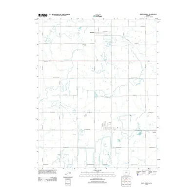
2012 Map of West Mineral
USGS Topo · Published 2012About this map
Monmouth and Carona anchor this landscape in Cherokee County, Kansas, where the rural grid is defined by a complex network of waterways including Lightning Cr, Mulberry Cr, and Cherry Cr. The area’s history is preserved in several family and community burial grounds, such as Monmouth Cem, Rigney Cem, and Borland Cem, which serve as vital markers for local genealogists. Evidence of the region’s coal mining legacy is visible through industrial road names like NW Coal Valley Rd and NW Coalfield Rd, while Mineral Lake and the prominent Bell Mound offer distinctive topographical landmarks. The map details the transition from small settlement centers like Carona to the surrounding agricultural fields and riparian corridors, providing a clear record of the modern infrastructure and natural drainage patterns of this southeastern Kansas corridor.
Find a feature on this map
32 named features on this map. Tap any name to fly to it.
Don’t see what you’re looking for? This feature index may not catch every label — zoom into the map to look around manually.
Map Details
Editions of this 2012 West Mineral Map
This is the sole edition of this map. No revisions or reprints were ever made.
Other maps of this area

1886 · Joplin
USGS Topo · 1:125,000

1886 · Parsons
USGS Topo · 1:125,000

1893 · Parsons
USGS Topo · 1:125,000

1894 · Joplin
USGS Topo · 1:125,000

1918 · Columbus
USGS Topo · 1:62,500

1943 · McCune
USGS Topo · 1:62,500

1943 · Cherokee
USGS Topo · 1:62,500

1944 · Oswego
USGS Topo · 1:62,500

1945 · Mc Cune
USGS Topo · 1:62,500

1945 · Cherokee
USGS Topo · 1:62,500