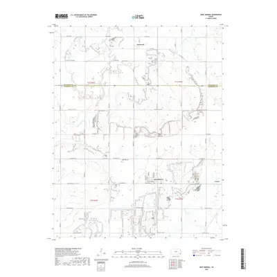
2018 Map of West Mineral
USGS Topo · Published 2018About this map
West Mineral and the neighboring settlements of Monmouth and Carona anchor this portion of the Kansas coal region. The landscape is heavily defined by its industrial legacy, featuring numerous unnamed surface impoundments and modified terrain, including the prominent Bell Mound. A network of section-line roads, such as NW Coal Valley Rd and NW Coalfield Rd, crisscrosses the township lines between t31s r22e and t32s r23e. Genealogists will find several burial sites preserved across the landscape, from Monmouth Cem in the north to Borland Cem and Star Cem further south. The drainage patterns of Lightning Creek and its tributaries, including Stink Br and Plum Cr, navigate around these altered landforms, reflecting the intersection of natural hydrology and intensive human activity along the boundary of Crawford and Cherokee Counties.
Find a feature on this map
51 named features on this map. Tap any name to fly to it.
Don’t see what you’re looking for? This feature index may not catch every label — zoom into the map to look around manually.
Map Details
Editions of this 2018 West Mineral Map
This is the sole edition of this map. No revisions or reprints were ever made.
Other maps of this area

1886 · Joplin
USGS Topo · 1:125,000

1886 · Parsons
USGS Topo · 1:125,000

1893 · Parsons
USGS Topo · 1:125,000

1894 · Joplin
USGS Topo · 1:125,000

1918 · Columbus
USGS Topo · 1:62,500

1943 · McCune
USGS Topo · 1:62,500

1943 · Cherokee
USGS Topo · 1:62,500

1944 · Oswego
USGS Topo · 1:62,500

1945 · Mc Cune
USGS Topo · 1:62,500

1945 · Cherokee
USGS Topo · 1:62,500