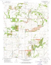
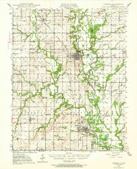
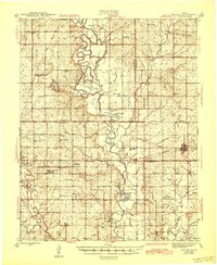
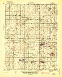
1973 Map of West Mineral
USGS Topo · Published 1975About this map
Extensive industrial activity defines this portion of Cherokee and Crawford counties in the early 1970s. The landscape is dominated by numerous Strip Mine operations and excavations, which have reshaped the terrain around West Mineral and Monmouth. These massive earth-moving projects exist alongside long-established rural landmarks, including the Monmouth Cem, Van Slyke Cem, and Star Cem. The presence of Bell Mound provides a natural contrast to the man-made topography of pits and ridges.
Find a feature on this map
28 named features on this map. Tap any name to fly to it.
Don’t see what you’re looking for? This feature index may not catch every label — zoom into the map to look around manually.
Map Details
Editions of this 1973 West Mineral Map
This is the sole edition of this map. No revisions or reprints were ever made.
Other maps of this area

1886 · Joplin
USGS Topo · 1:125,000

1886 · Parsons
USGS Topo · 1:125,000

1893 · Parsons
USGS Topo · 1:125,000

1894 · Joplin
USGS Topo · 1:125,000
1918 · Columbus
USGS Topo · 1:62,500
1943 · McCune
USGS Topo · 1:62,500
1943 · Cherokee
USGS Topo · 1:62,500
1944 · Oswego
USGS Topo · 1:62,500
1945 · Mc Cune
USGS Topo · 1:62,500
1945 · Cherokee
USGS Topo · 1:62,500