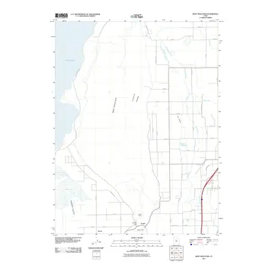
2011 Map of West Mountain
USGS Topo · Published 2011About this map
West Mountain dominates the center of this Utah County landscape, rising between the southern shores of Utah Lake and the agricultural lands of Goshen Valley. This 2011 survey documents the industrial and rural character of the area, anchored by the massive Keigley Quarry near the settlement of Keigley. To the west, the shoreline is traced by S Lincoln Beach Dr, while the eastern portion of the map is defined by a network of drainage sloughs and creeks, including Benjamin Slough and Spring Creek, which feed into the lake. The small town of Genola is situated at the southern base of the mountain, marking a transition from the elevated terrain of Long Ridge to the low-lying wetlands around White Lake. This map captures a moment of modern land use where heavy industry and traditional farming intersect against a backdrop of prominent Great Basin relief.
Find a feature on this map
36 named features on this map. Tap any name to fly to it.
Don’t see what you’re looking for? This feature index may not catch every label — zoom into the map to look around manually.
Map Details
Editions of this 2011 West Mountain Map
This is the sole edition of this map. No revisions or reprints were ever made.
Other maps of this area

1885 · Salt Lake
USGS Topo · 1:250,000

1885 · Manti
USGS Topo · 1:250,000

1895 · Manti
USGS Topo · 1:250,000

1948 · Spanish Fork
USGS Topo · 1:24,000

1948 · Provo
USGS Topo · 1:24,000

1949 · Provo
USGS Topo · 1:62,500

1950 · Provo
USGS Topo · 1:24,000

1950 · Spanish Fork
USGS Topo · 1:24,000

1950 · West Mountain
USGS Topo · 1:24,000
1950 · Goshen Valley North
USGS Topo · 1:24,000