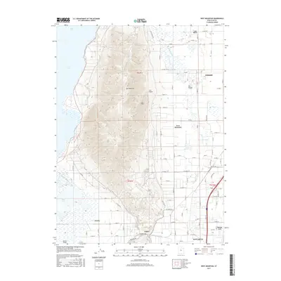
2017 Map of West Mountain
USGS Topo · Published 2017About this map
West Mountain dominates this portion of the Utah County landscape, rising sharply between the southern reaches of Utah Lake and the agricultural lands to the east. The terrain transitions from the marshy lowlands of White Lake and the Benjamin Slough into the defined ridges of Long Ridge and the shadowed recesses of Long Canyon and Dry Hollow. These natural features have historically dictated the placement of settlements and the layout of the grid system for local roads.
Find a feature on this map
62 named features on this map. Tap any name to fly to it.
Don’t see what you’re looking for? This feature index may not catch every label — zoom into the map to look around manually.
Map Details
Editions of this 2017 West Mountain Map
This is the sole edition of this map. No revisions or reprints were ever made.
Other maps of this area

1885 · Salt Lake
USGS Topo · 1:250,000

1885 · Manti
USGS Topo · 1:250,000

1895 · Manti
USGS Topo · 1:250,000

1948 · Spanish Fork
USGS Topo · 1:24,000

1948 · Provo
USGS Topo · 1:24,000

1949 · Provo
USGS Topo · 1:62,500

1950 · Provo
USGS Topo · 1:24,000

1950 · Spanish Fork
USGS Topo · 1:24,000

1950 · West Mountain
USGS Topo · 1:24,000
1950 · Goshen Valley North
USGS Topo · 1:24,000