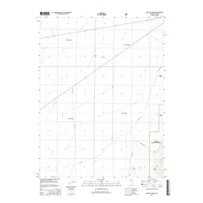
2014 Map of West of Austin
USGS Topo · Published 2014About this map
Reese River and Birchum Slough define the northern valley floor of this Great Basin landscape, illustrating the critical role of water in the high desert of Central Nevada. To the southeast, the terrain rises sharply into the Toiyabe National Forest, where a series of deep drainages including Indian Canyon, Porter Canyon, and First Canyon cut through the mountains. This 2014 survey shows the area as it serves primarily as a transit corridor and gateway to the surrounding wilderness. The presence of the Austin Airport and the small settlement at Canon City marks the limit of valley development before the land gives way to steep slopes and national forest boundaries. A network of rural routes such as Gold Rd and Big Creek Rd provide access to the canyons, tracing the same paths likely used by miners and ranchers for over a century.
Find a feature on this map
20 named features on this map. Tap any name to fly to it.
Don’t see what you’re looking for? This feature index may not catch every label — zoom into the map to look around manually.
Map Details
Editions of this 2014 West of Austin Map
This is the sole edition of this map. No revisions or reprints were ever made.
Other maps of this area

1955 · Millett
USGS Topo · 1:250,000

1956 · Austin
USGS Topo · 1:62,500

1959 · Millett
USGS Topo · 1:250,000

1969 · Yankee Blade
USGS Topo · 1:24,000

1969 · Vigus Butte
USGS Topo · 1:24,000

1969 · Gandolfo Canyon
USGS Topo · 1:24,000

1969 · Mount Airy Mesa
USGS Topo · 1:24,000

1969 · Dutch Flat
USGS Topo · 1:24,000

1983 · Edwards Creek Valley
USGS Topo · 1:100,000

1985 · Smith Creek Valley
USGS Topo · 1:100,000