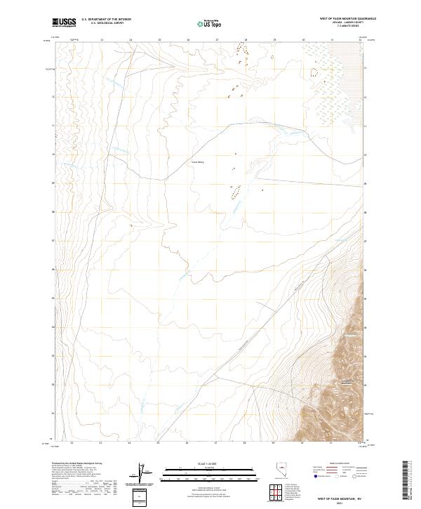
2021 Map of West of Fagin Mountain
USGS Topo · Published 2021About this map
Grass Valley dominates the central floor of this high-desert landscape in central Nevada, framed to the southeast by the rising slopes of the Simpson Park Mountains. This modern topographical survey depicts a region defined by its seasonal hydrology, where several intermittent drainages such as Corral Canyon Cr and Cowboy Rest Cr descend from the surrounding highlands to the valley floor. The placement of Valley Spring and Fagin Springs indicates the vital importance of reliable water sources in this arid environment, often serving as critical points for livestock and land management.
Find a feature on this map
15 named features on this map. Tap any name to fly to it.
Don’t see what you’re looking for? This feature index may not catch every label — zoom into the map to look around manually.
Map Details
Editions of this 2021 West of Fagin Mountain Map
This is the sole edition of this map. No revisions or reprints were ever made.
Other maps of this area

1926 · Roberts Mountains
USGS Topo · 1:250,000

1929 · Roberts Mountains
USGS Topo · 1:250,000

1955 · Millett
USGS Topo · 1:250,000

1956 · Mount Callaghan
USGS Topo · 1:62,500

1956 · Walti Hot Springs
USGS Topo · 1:62,500

1956 · Hall Creek
USGS Topo · 1:62,500

1956 · Ackerman Canyon
USGS Topo · 1:62,500

1959 · Millett
USGS Topo · 1:250,000

1979 · Simpson Park Mtns
USGS Topo · 1:100,000
1986 · Walti Hot Springs
USGS Topo · 1:24,000