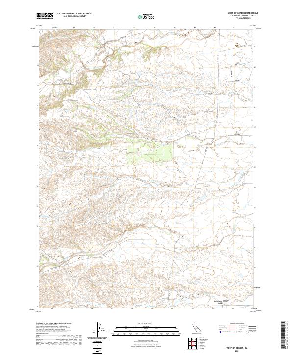
2021 Map of West of Gerber
USGS Topo · Published 2021About this map
The western edge of the Sacramento Valley in Tehama County is defined by a dense network of seasonal drainages that carve through the landscape toward the east. Major watercourses like Red Bank Creek in the north and Elder Cr further south illustrate the hydrological patterns that have shaped land use and road development in this part of California. The modern road network follows these natural contours, with routes like Rancho Tehama Rd and Paskenta Rd providing vital links between rural properties and neighboring communities. Smaller seasonal streams, including Oat Cr, Willow Cr, and McClure Cr, further fragment the terrain, creating the undulating topography characteristic of the valley's foothills. This survey offers a detailed view of the township and range divisions, showing the enduring influence of the Public Land Survey System on local property boundaries and access roads.
Find a feature on this map
29 named features on this map. Tap any name to fly to it.
Don’t see what you’re looking for? This feature index may not catch every label — zoom into the map to look around manually.
Map Details
Editions of this 2021 West of Gerber Map
This is the sole edition of this map. No revisions or reprints were ever made.
Other maps of this area

1890 · Red Bluff
USGS Topo · 1:250,000

1894 · Red Bluff
USGS Topo · 1:250,000

1904 · Vina
USGS Topo · 1:62,500

1905 · Tehama
USGS Topo · 1:62,500

1944 · Flournoy
USGS Topo · 1:62,500

1950 · Gerber
USGS Topo · 1:24,000

1951 · Gerber
USGS Topo · 1:24,000
1951 · Corning
USGS Topo · 1:24,000

1951 · Red Bluff East
USGS Topo · 1:24,000

1951 · West of Gerber
USGS Topo · 1:24,000