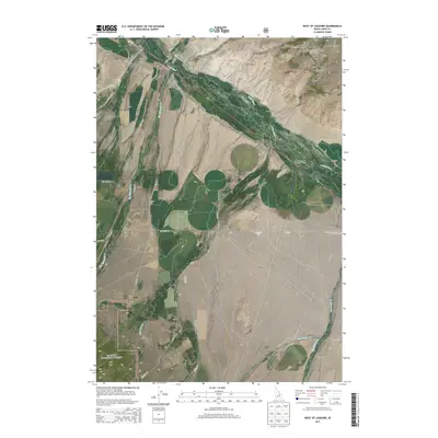
2013 Map of West of Leadore
USGS Topo · Published 2013About this map
The Lemhi Valley serves as a central corridor for this Idaho mountain landscape, where the Lemhi River flows through a series of gulches and high-altitude slopes. In the northeast, the Salmon National Forest blankets the terrain around Mineral Hill, a site indicative of the region's mining and prospecting history. The map records a distinct agricultural and ranching infrastructure, evidenced by the network of local roads such as Lemhi Back Rd and Lee Creek Rd that navigate the varied elevations.
Find a feature on this map
33 named features on this map. Tap any name to fly to it.
Don’t see what you’re looking for? This feature index may not catch every label — zoom into the map to look around manually.
Map Details
Editions of this 2013 West of Leadore Map
This is the sole edition of this map. No revisions or reprints were ever made.
Other maps of this area

1955 · Dubois
USGS Topo · 1:250,000

1956 · Leadore
USGS Topo · 1:62,500

1956 · Patterson
USGS Topo · 1:62,500

1956 · Lemhi
USGS Topo · 1:62,500

1958 · Dubois
USGS Topo · 1:250,000

1965 · Bannock Pass
USGS Topo · 1:24,000
1965 · Goat Mountain
USGS Topo · 1:24,000

1980 · Leadore
USGS Topo · 1:100,000
1987 · West of Leadore
USGS Topo · 1:24,000

1987 · Purcell Spring
USGS Topo · 1:24,000