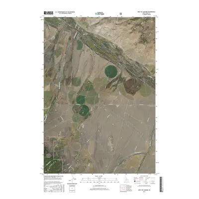
2017 Map of West of Leadore
USGS Topo · Published 2017About this map
Lemhi Valley and the surrounding high-altitude drainage systems define this section of the Salmon National Forest. The landscape is dominated by the Lemhi River corridor, which serves as the primary axis for local ranching and transit via Lemhi Rd. Tributaries such as Big Eightmile Cr and Milk Cr descend from the upland basins, reflecting a land-use pattern focused on water rights and livestock grazing.
Find a feature on this map
39 named features on this map. Tap any name to fly to it.
Don’t see what you’re looking for? This feature index may not catch every label — zoom into the map to look around manually.
Map Details
Editions of this 2017 West of Leadore Map
This is the sole edition of this map. No revisions or reprints were ever made.
Other maps of this area

1955 · Dubois
USGS Topo · 1:250,000

1956 · Leadore
USGS Topo · 1:62,500

1956 · Patterson
USGS Topo · 1:62,500

1956 · Lemhi
USGS Topo · 1:62,500

1958 · Dubois
USGS Topo · 1:250,000

1965 · Bannock Pass
USGS Topo · 1:24,000
1965 · Goat Mountain
USGS Topo · 1:24,000

1980 · Leadore
USGS Topo · 1:100,000
1987 · West of Leadore
USGS Topo · 1:24,000

1987 · Purcell Spring
USGS Topo · 1:24,000