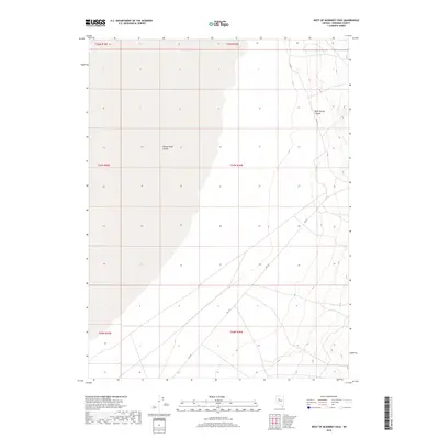
2018 Map of West of McKinney Pass
USGS Topo · Published 2018About this map
Buena Vista Valley dominates the western half of this 2018 study, showcasing the expansive, low-lying drainage typical of the Great Basin's basin-and-range topography. The eastern edge of the map rises sharply toward the Humboldt Range, defined by the drainage of Root Spring Canyon. These stark elevation changes are captured in 20-foot contour intervals, illustrating the divide between the flat valley floor and the high-desert mountain flanks. Infrastructure is sparse, primarily consisting of the Fas 615 roadway which skirts the base of the mountains. The survey accurately maintains the Public Land Survey System grid across multiple townships, including t27n r36e, providing a precise reference for land ownership and geodetic positioning in a largely uninhabited stretch of Pershing County.
Find a feature on this map
9 named features on this map. Tap any name to fly to it.
Don’t see what you’re looking for? This feature index may not catch every label — zoom into the map to look around manually.
Map Details
Editions of this 2018 West of McKinney Pass Map
This is the sole edition of this map. No revisions or reprints were ever made.
Other maps of this area

1931 · Lovelock
USGS Topo · 1:250,000

1932 · Sonoma Range
USGS Topo · 1:250,000

1935 · Lovelock
USGS Topo · 1:250,000

1939 · Sonoma Range
USGS Topo · 1:250,000

1954 · Unionville
USGS Topo · 1:62,500

1954 · Buffalo Mtn
USGS Topo · 1:62,500

1955 · Lovelock
USGS Topo · 1:250,000

1955 · Winnemucca
USGS Topo · 1:250,000

1958 · Winnemucca
USGS Topo · 1:250,000

1959 · Lovelock
USGS Topo · 1:250,000