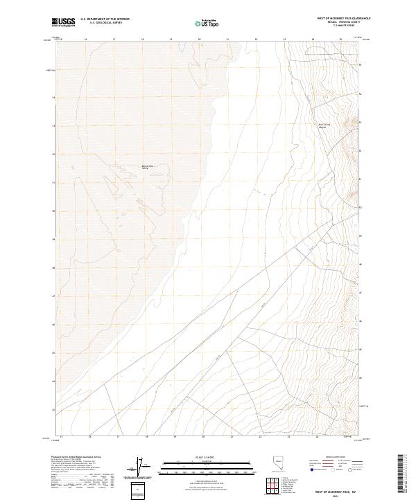
2021 Map of West of McKinney Pass
USGS Topo · Published 2021About this map
Buena Vista Valley dominates the western portion of this Pershing County landscape, appearing as a broad, relatively level basin floor. The terrain shifts dramatically on the eastern edge as the land rises into the corrugated slopes of the mountain range, carved by features like Root Spring Canyon. This 2021 survey shows a sparsely developed region where transportation is defined by Fas-615, a secondary route that skirts the base of the mountains. The map illustrates a classic Great Basin transition from flat valley bottom to steep upland drainage, highlighting the spatial relationship between the open valley and the high-elevation canyons that define this part of Nevada.
Find a feature on this map
9 named features on this map. Tap any name to fly to it.
Don’t see what you’re looking for? This feature index may not catch every label — zoom into the map to look around manually.
Map Details
Editions of this 2021 West of McKinney Pass Map
This is the sole edition of this map. No revisions or reprints were ever made.
Other maps of this area

1931 · Lovelock
USGS Topo · 1:250,000

1932 · Sonoma Range
USGS Topo · 1:250,000

1935 · Lovelock
USGS Topo · 1:250,000

1939 · Sonoma Range
USGS Topo · 1:250,000

1954 · Unionville
USGS Topo · 1:62,500

1954 · Buffalo Mtn
USGS Topo · 1:62,500

1955 · Lovelock
USGS Topo · 1:250,000

1955 · Winnemucca
USGS Topo · 1:250,000

1958 · Winnemucca
USGS Topo · 1:250,000

1959 · Lovelock
USGS Topo · 1:250,000