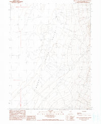
1990 Map of West of McKinney Pass
USGS Topo · Published 1990About this map
Buena Vista Valley dominates this arid basin landscape in Pershing County, where the transition between high desert terrain and prehistoric lakebeds is clearly marked. The map traces the prominent Dry Lake Shore Line as it edges against the Alkali Flat, a remnant of the region's ancient hydrological history. In an area defined by its scarcity of water, isolated resources like a Spring and a Well provide essential markers for land use and survival in the basin. The landscape is further characterized by deposits of Sand and the broad, open reach of Antelope to the south. Man-made interventions are sparse but specific, including a Borrow Pit and a network of 4wd tracks that represent the modern human footprint within this expansive alluvial environment.
Find a feature on this map
12 named features on this map. Tap any name to fly to it.
Don’t see what you’re looking for? This feature index may not catch every label — zoom into the map to look around manually.
Map Details
Editions of this 1990 West of McKinney Pass Map
This is the sole edition of this map. No revisions or reprints were ever made.
Other maps of this area

1931 · Lovelock
USGS Topo · 1:250,000

1932 · Sonoma Range
USGS Topo · 1:250,000

1935 · Lovelock
USGS Topo · 1:250,000

1939 · Sonoma Range
USGS Topo · 1:250,000

1954 · Unionville
USGS Topo · 1:62,500

1954 · Buffalo Mtn
USGS Topo · 1:62,500

1955 · Lovelock
USGS Topo · 1:250,000

1955 · Winnemucca
USGS Topo · 1:250,000

1958 · Winnemucca
USGS Topo · 1:250,000

1959 · Lovelock
USGS Topo · 1:250,000