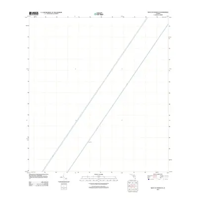
2012 Map of West of Pennsuco
USGS Topo · Published 2012About this map
Levee 67C dominates the landscape of this portion of Miami-Dade County, representing a critical piece of the massive water management infrastructure in southern Florida. The map illustrates the linear geometry of the Central and Southern Florida Flood Control Project, highlighting how the natural Everglades terrain was partitioned by major canal and levee systems like L-67-A and L-67-C. This specific area, located west of the Pennsuco region, shows a landscape defined entirely by these engineered water control features, which manage the flow and containment of surface water across the basin. For researchers of environmental history or regional infrastructure, the survey provides a precise look at the spatial relationship between these parallel structures during the early 21st century.
Find a feature on this map
3 named features on this map. Tap any name to fly to it.
Don’t see what you’re looking for? This feature index may not catch every label — zoom into the map to look around manually.
Map Details
Editions of this 2012 West of Pennsuco Map
This is the sole edition of this map. No revisions or reprints were ever made.
Other maps of this area

1956 · Miami
USGS Topo · 1:250,000

1956 · West Palm Beach
USGS Topo · 1:250,000

1957 · West Palm Beach
USGS Topo · 1:250,000

1958 · West Palm Beach
USGS Topo · 1:250,000

1958 · Miami
USGS Topo · 1:250,000

1963 · Pennsuco
USGS Topo · 1:24,000

1963 · Cooper City SW
USGS Topo · 1:24,000

1973 · Custard Apple Hammock
USGS Topo · 1:24,000

1973 · West Of Pennsuco
USGS Topo · 1:24,000

1973 · Everglades 4 SE
USGS Topo · 1:24,000