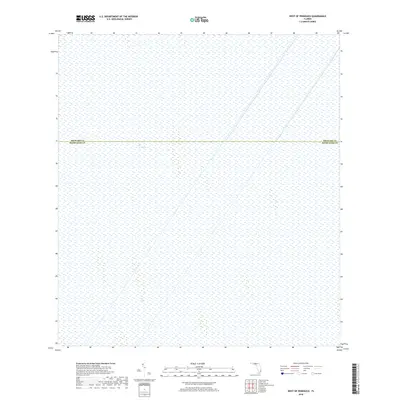
2018 Map of West of Pennsuco
USGS Topo · Published 2018About this map
The Everglades dominates this 2018 survey, providing a focused look at the vast freshwater wetlands as they appeared in the early 21st century. This specific quadrangle covers a segment of the river of grass where the administrative boundary between Broward Co and Miami-Dade Co divides the landscape. The map captures a largely untouched environment, notable for the absence of modern roads, structures, or industrial development that characterizes much of South Florida. One of the few named topographical features within this expanse is the area identified as The Pocket, illustrating the subtle variation in hydrography and vegetation patterns that define this ecosystem. For researchers and conservationists, this sheet serves as a record of wetland extent and jurisdictional lines within one of the country's most significant natural regions.
Find a feature on this map
3 named features on this map. Tap any name to fly to it.
Don’t see what you’re looking for? This feature index may not catch every label — zoom into the map to look around manually.
Map Details
Editions of this 2018 West of Pennsuco Map
This is the sole edition of this map. No revisions or reprints were ever made.
Other maps of this area

1956 · Miami
USGS Topo · 1:250,000

1956 · West Palm Beach
USGS Topo · 1:250,000

1957 · West Palm Beach
USGS Topo · 1:250,000

1958 · West Palm Beach
USGS Topo · 1:250,000

1958 · Miami
USGS Topo · 1:250,000

1963 · Pennsuco
USGS Topo · 1:24,000

1963 · Cooper City SW
USGS Topo · 1:24,000

1973 · Custard Apple Hammock
USGS Topo · 1:24,000

1973 · West Of Pennsuco
USGS Topo · 1:24,000

1973 · Everglades 4 SE
USGS Topo · 1:24,000