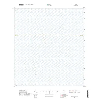
2021 Map of West of Pennsuco
USGS Topo · Published 2021About this map
The Everglades dominate this landscape, illustrating the vast wetland ecosystem at the southern tip of the Florida peninsula. This 2021 survey shows a primitive, water-saturated environment where human infrastructure is largely absent, save for the political division between Broward Co and Miami-Dade Co. The map documents a segment of the river of grass as it remained in the early 21st century, punctuated only by a specific hydrographic feature known as The Pocket in the southern portion of the quadrangle. As a modern US Topo product, it provides a precise technical baseline for environmental monitoring and hydrological study within this protected wilderness area.
Find a feature on this map
5 named features on this map. Tap any name to fly to it.
Don’t see what you’re looking for? This feature index may not catch every label — zoom into the map to look around manually.
Map Details
Editions of this 2021 West of Pennsuco Map
This is the sole edition of this map. No revisions or reprints were ever made.
Other maps of this area

1956 · Miami
USGS Topo · 1:250,000

1956 · West Palm Beach
USGS Topo · 1:250,000

1957 · West Palm Beach
USGS Topo · 1:250,000

1958 · West Palm Beach
USGS Topo · 1:250,000

1958 · Miami
USGS Topo · 1:250,000

1963 · Pennsuco
USGS Topo · 1:24,000

1963 · Cooper City SW
USGS Topo · 1:24,000

1973 · Custard Apple Hammock
USGS Topo · 1:24,000

1973 · West Of Pennsuco
USGS Topo · 1:24,000

1973 · Everglades 4 SE
USGS Topo · 1:24,000