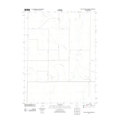
2012 Map of West of Russell Springs
USGS Topo · Published 2012About this map
The Smoky Hill River and its tributary, the N Fork Smoky Hill River, dominate this western Kansas landscape in Logan County. This 2012 survey reveals a highly organized rural grid system, where named local roads such as Topeka, Rawhide, and Quail define property boundaries and access points across the plains. These labels reflect a local naming convention that often draws from regional history and nature, typical of the High Plains agricultural stretches. The river system meanders across the central and southern portions of the map, carving slight depressions into the terrain that dictate the placement of local infrastructure. For the historian or researcher, the map provides a contemporary view of these perennial watercourses before they intersect further east, alongside the network of county roads like Co RD-190 and Co RD-180 that support the area's modern land use.
Find a feature on this map
13 named features on this map. Tap any name to fly to it.
Don’t see what you’re looking for? This feature index may not catch every label — zoom into the map to look around manually.
Map Details
Editions of this 2012 West of Russell Springs Map
This is the sole edition of this map. No revisions or reprints were ever made.
Other maps of this area

1954 · Goodland
USGS Topo · 1:250,000

1955 · Scott City
USGS Topo · 1:250,000

1956 · Goodland
USGS Topo · 1:250,000

1957 · Goodland
USGS Topo · 1:250,000

1958 · Scott City
USGS Topo · 1:250,000

1969 · Russell Springs 2 NW
USGS Topo · 1:24,000

1969 · Mc Allaster SE
USGS Topo · 1:24,000

1969 · Russell Springs 2 SW
USGS Topo · 1:24,000

1969 · Russell Springs 2 NE
USGS Topo · 1:24,000

1969 · Russell Springs 2 SE
USGS Topo · 1:24,000