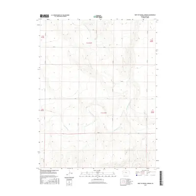
2015 Map of West of Russell Springs
USGS Topo · Published 2015About this map
The Smoky Hill River and its N Fork Smoky Hill River carve a meandering path through this Logan County landscape, defining the topography of the High Plains. This 2015 survey by the U.S. Geological Survey shows a strictly gridded section of Kansas, where the township and range system dictates a network of rural routes. Local roads, often bearing evocative names like Rawhide, Quail, Topeka, and Osage, provide access across the drainages. The map reveals the deep rural character of the region west of Russell Springs, where human activity is primarily expressed through these named section roads and the management of water resources along the river valleys.
Find a feature on this map
17 named features on this map. Tap any name to fly to it.
Don’t see what you’re looking for? This feature index may not catch every label — zoom into the map to look around manually.
Map Details
Editions of this 2015 West of Russell Springs Map
This is the sole edition of this map. No revisions or reprints were ever made.
Other maps of this area

1954 · Goodland
USGS Topo · 1:250,000

1955 · Scott City
USGS Topo · 1:250,000

1956 · Goodland
USGS Topo · 1:250,000

1957 · Goodland
USGS Topo · 1:250,000

1958 · Scott City
USGS Topo · 1:250,000

1969 · Russell Springs 2 NW
USGS Topo · 1:24,000

1969 · Mc Allaster SE
USGS Topo · 1:24,000

1969 · Russell Springs 2 SW
USGS Topo · 1:24,000

1969 · Russell Springs 2 NE
USGS Topo · 1:24,000

1969 · Russell Springs 2 SE
USGS Topo · 1:24,000