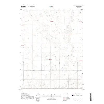
2018 Map of West of Russell Springs
USGS Topo · Published 2018About this map
The Smoky Hill River and the N Fork Smoky Hill River dominate this high plains landscape in western Kansas. This 2018 survey reveals a sparse, strictly organized grid of rural infrastructure where county roads such as Co RD 160 and Co RD 220 define the movement across the terrain. The presence of named east-west routes like Osage, Quail, Rawhide, and Topeka suggests a systematic approach to local navigation within the township and range system, specifically within t13s r36w and its surrounding blocks. The map highlights the contrast between the flat upland plateaus and the intricate drainage patterns carved by the river forks, providing a detailed view of the natural hydrology that has dictated land use and property boundaries in Logan County for generations.
Find a feature on this map
18 named features on this map. Tap any name to fly to it.
Don’t see what you’re looking for? This feature index may not catch every label — zoom into the map to look around manually.
Map Details
Editions of this 2018 West of Russell Springs Map
This is the sole edition of this map. No revisions or reprints were ever made.
Other maps of this area

1954 · Goodland
USGS Topo · 1:250,000

1955 · Scott City
USGS Topo · 1:250,000

1956 · Goodland
USGS Topo · 1:250,000

1957 · Goodland
USGS Topo · 1:250,000

1958 · Scott City
USGS Topo · 1:250,000

1969 · Russell Springs 2 NW
USGS Topo · 1:24,000

1969 · Mc Allaster SE
USGS Topo · 1:24,000

1969 · Russell Springs 2 SW
USGS Topo · 1:24,000

1969 · Russell Springs 2 NE
USGS Topo · 1:24,000

1969 · Russell Springs 2 SE
USGS Topo · 1:24,000