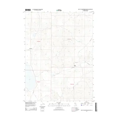
2015 Map of West of Snowstorm Mountain
USGS Topo · Published 2015About this map
Horse Lake and the surrounding high desert terrain dominate this corner of Lassen County, where drainage networks and seasonal water sources define the human footprint. The settlement of Shumway sits at the intersection of local routes like Hansen Rd, while the broader landscape is shaped by the transition from the lakebed to the rising slopes of the Snowstorm Mountain area. Hydrological features such as Snowstorm Wetland and the isolated White Horse Spring provide essential water in an otherwise arid environment, connected by the intermittent flows of Snowstorm Cr and Petes Cr. The Public Land Survey System grid, including boundaries like t33n r13e and t32n r14e, provides a structured view of land division in this section of Northern California, where unpaved corridors like Horse Lake Rd and Snowstorm Rd serve as the primary conduits through the basin.
Find a feature on this map
14 named features on this map. Tap any name to fly to it.
Don’t see what you’re looking for? This feature index may not catch every label — zoom into the map to look around manually.
Map Details
Editions of this 2015 West of Snowstorm Mountain Map
This is the sole edition of this map. No revisions or reprints were ever made.
Other maps of this area

1886 · Honey Lake
USGS Topo · 1:250,000

1891 · Honey Lake
USGS Topo · 1:250,000

1893 · Honey Lake
USGS Topo · 1:250,000

1954 · Karlo
USGS Topo · 1:62,500

1954 · Grasshopper Valley
USGS Topo · 1:62,500

1954 · Ravendale
USGS Topo · 1:62,500

1954 · Fredonyer Peak
USGS Topo · 1:62,500

1955 · Westwood
USGS Topo · 1:250,000

1958 · Westwood
USGS Topo · 1:250,000

1959 · Westwood
USGS Topo · 1:250,000