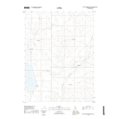
2018 Map of West of Snowstorm Mountain
USGS Topo · Published 2018About this map
Shumway sits at the western edge of this High Desert landscape in Lassen County, where historical transit and hydrology define the terrain. The area is characterized by the expansive Horse Lake and the intricate Snowstorm Wetland, which serve as vital catchments for Snowstorm Cr and Petes Cr. The conversion of old infrastructure is evident in the Modoc Line Rail Trail, which traces the path of a former railway through the eastern portion of the map, providing a tangible link to the region's transportation history. Local landmarks such as White Horse Spring and a network of rural routes including Hansen Rd and Horse Lake Rd connect the scattered points of settlement and water resources. The map captures a moment in the early 21st century when the legacy of the Modoc Line transitioned from a corridor of steam and steel to one of recreation and conservation.
Find a feature on this map
16 named features on this map. Tap any name to fly to it.
Don’t see what you’re looking for? This feature index may not catch every label — zoom into the map to look around manually.
Map Details
Editions of this 2018 West of Snowstorm Mountain Map
This is the sole edition of this map. No revisions or reprints were ever made.
Other maps of this area

1886 · Honey Lake
USGS Topo · 1:250,000

1891 · Honey Lake
USGS Topo · 1:250,000

1893 · Honey Lake
USGS Topo · 1:250,000

1954 · Karlo
USGS Topo · 1:62,500

1954 · Grasshopper Valley
USGS Topo · 1:62,500

1954 · Ravendale
USGS Topo · 1:62,500

1954 · Fredonyer Peak
USGS Topo · 1:62,500

1955 · Westwood
USGS Topo · 1:250,000

1958 · Westwood
USGS Topo · 1:250,000

1959 · Westwood
USGS Topo · 1:250,000