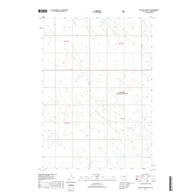
2017 Map of West of Stony Butte
USGS Topo · Published 2017About this map
Fort Pierre National Grassland dominates this portion of Jones County, preserving a vast expanse of open prairie as it appeared in 2017. The terrain is defined by the drainage patterns of the E Br War Cr and W Br War Cr, which carve through the landscape south of the Sheriff Reservoir. This survey illustrates the essential role of water management in this arid region, highlighted by features like the Kennedy Number One Reservoir. The transportation network is sparse, primarily composed of rural routes such as Co Rd N 15 and Angus Dr, reflecting a low-density ranching environment where section lines dictate the movement of people and livestock across the rolling grasslands.
Find a feature on this map
14 named features on this map. Tap any name to fly to it.
Don’t see what you’re looking for? This feature index may not catch every label — zoom into the map to look around manually.
Map Details
Editions of this 2017 West of Stony Butte Map
This is the sole edition of this map. No revisions or reprints were ever made.
Other maps of this area

1953 · Wendte NE
USGS Topo · 1:24,000

1953 · Pierre 3 NW
USGS Topo · 1:24,000

1954 · Pierre
USGS Topo · 1:250,000

1955 · Martin
USGS Topo · 1:250,000

1958 · Pierre
USGS Topo · 1:250,000

1958 · Martin
USGS Topo · 1:250,000

1972 · Pierre 3 SW
USGS Topo · 1:24,000

1972 · Draper
USGS Topo · 1:24,000

1972 · Pierre 3 SE
USGS Topo · 1:24,000

1972 · Vivian
USGS Topo · 1:24,000