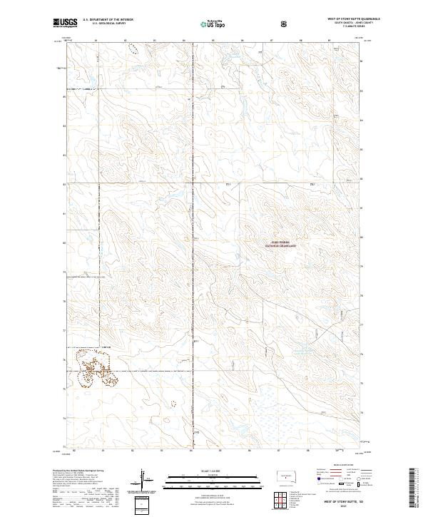
2021 Map of West of Stony Butte
USGS Topo · Published 2021About this map
Fort Pierre National Grassland dominates this section of the South Dakota prairie, preserving a landscape defined by rolling topography and critical water management. The drainage patterns of the W Br War Cr and E Br War Cr structure the terrain, leading toward engineered catchments like the Sheriff Reservoir and Kennedy Number One Reservoir. These features highlight the importance of water storage in an area primarily used for grazing and conservation. The rural road network, including Co Rd N 15 and Angus Dr, follows the Public Land Survey System grid, providing access to the remote township sections of T1N and T2N. This map serves as a detailed record of land use and hydrology within the grassland during the early 21st century.
Find a feature on this map
14 named features on this map. Tap any name to fly to it.
Don’t see what you’re looking for? This feature index may not catch every label — zoom into the map to look around manually.
Map Details
Editions of this 2021 West of Stony Butte Map
This is the sole edition of this map. No revisions or reprints were ever made.
Other maps of this area

1953 · Wendte NE
USGS Topo · 1:24,000

1953 · Pierre 3 NW
USGS Topo · 1:24,000

1954 · Pierre
USGS Topo · 1:250,000

1955 · Martin
USGS Topo · 1:250,000

1958 · Pierre
USGS Topo · 1:250,000

1958 · Martin
USGS Topo · 1:250,000

1972 · Pierre 3 SW
USGS Topo · 1:24,000

1972 · Draper
USGS Topo · 1:24,000

1972 · Pierre 3 SE
USGS Topo · 1:24,000

1972 · Vivian
USGS Topo · 1:24,000