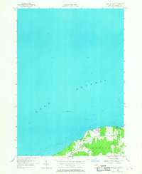
1955 Map of West Of Texas
USGS Topo · Published 1968About this map
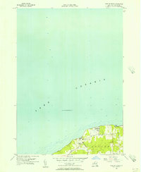
Lake Ontario dominates this mid-century survey, with its deep-water hydrography and bathymetry soundings reaching far offshore. The shoreline is defined by the Scriba town line and the transition from the lake's expanse to the developed coastal fringe. The map documents the presence of the U S Military Reservation Camp Oswego tucked along the coast, representing the era's strategic maritime presence on the Great Lakes. Inland, the rural character of Oswego County is preserved through local landmarks such as School No 16 and the small residential clusters at Lycoming and Lakeview. The transportation network of the time is visible through primary thoroughfares like Lakeview Road and Parkhurst Road, which provided essential access to the waterfront and the sheltering inlet of Sunset Bay.
Find a feature on this map
10 named features on this map. Tap any name to fly to it.
Don’t see what you’re looking for? This feature index may not catch every label — zoom into the map to look around manually.
Map Details
Editions of this 1955 West Of Texas Map
3 editions found
Other maps of this area

1900 · Oswego
USGS Topo · 1:62,500

1900 · Fulton
USGS Topo · 1:62,500

1943 · Oswego East
USGS Topo · 1:31,680

1943 · New Haven
USGS Topo · 1:31,680

1943 · Oswego West
USGS Topo · 1:31,680

1943 · Texas
USGS Topo · 1:31,680

1943 · West Of Texas
USGS Topo · 1:31,680
1954 · Oswego West
USGS Topo · 1:24,000
1954 · Oswego East
USGS Topo · 1:24,000
1955 · West Of Texas
USGS Topo · 1:24,000