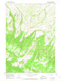
1964 Map of West Pass
USGS Topo · Published 1968About this map
Bighorn National Forest dominates this landscape, where the high-altitude terrain of Sheridan County meets a complex network of seasonal drainages and cattle ranges. The map reveals a land defined by its ranching heritage, with Fuller Ranch and Kern Ranch situated near the northern drainages of Red Gulch and Gay Creek. To the south, the topography rises sharply toward Dry Fork Ridge and the eponymous West Pass, a region marked by vital water sources like Lake Creek and various Springs. The inclusion of Winter Pasture and designated Cow Camp locations highlights the seasonal movement of livestock through these highlands. A web of Pack Trails and Jeep Trails provides the only access through the steep drainages of the Dry Fork and its numerous forks, showing a region that remained largely primitive and focused on grazing and timber well into the mid-1960s.
Find a feature on this map
36 named features on this map. Tap any name to fly to it.
Don’t see what you’re looking for? This feature index may not catch every label — zoom into the map to look around manually.
Map Details
Editions of this 1964 West Pass Map
This is the sole edition of this map. No revisions or reprints were ever made.
Other maps of this area

1894 · Rosebud
USGS Topo · 1:125,000

1894 · St. Xavier
USGS Topo · 1:125,000

1895 · Dayton
USGS Topo · 1:125,000

1898 · Bald Mountain
USGS Topo · 1:125,000

1901 · Rosebud
USGS Topo · 1:125,000

1901 · Dayton
USGS Topo · 1:125,000

1901 · St. Xavier
USGS Topo · 1:125,000

1901 · Bald Mountain
USGS Topo · 1:125,000

1954 · Hardin
USGS Topo · 1:250,000

1955 · Sheridan
USGS Topo · 1:250,000